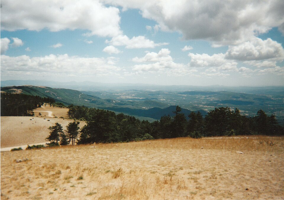
Auribeau · Cabrières-d’Aigues · Sivergues

walks: Grand Luberon

Each area has its own light, terrain and pace. Open the one that draws you in to find twenty routes.

20 walksCheck again before setting out.
Crêtes boisées et sommet du Grand Luberon

Discover

Ochre, cedar forest or high ridge: choose the landscape first.

Landscape

Sommet, crêtes et versants boisés

Explore perched villages, limestone hills and quiet valleys at your own pace. Every idea links to a detailed route source.

Effort

Demi-journée soutenue à grande journée

The rating is only a starting point. Consider terrain, heat, distance and the experience of everyone in your party.

Shade

Variable, faible en hauteur

Choose your start time, water supply and route with a generous margin.

Best time

Avril à juin, septembre à novembre

From 15 June to 15 September, check the official wildfire risk and access restrictions immediately before leaving.

Discover

Three walks to bring the idea to life.

These suggestions offer three possible rhythms. Always open the complete source description before leaving.

Walks in this area

20 walks

Let a place catch your eye, then check distance, ascent, time and current conditions on the route source.

01Visorando

Boucle de la Citerne au départ de Cucuron

Distance15,08 kmAscent+661 mTime6 h 10
ModerateOpen route
02Visorando

Le Mourre Nègre par Cucuron

Distance21,27 kmAscent+862 mTime8 h 30
ChallengingOpen route
03Visorando

De Cucuron à Vitrolles-en-Lubéron

Distance25,13 kmAscent+1 204 mTime10 h 35
ChallengingOpen route
04Visorando

Cucuron–Vaugines par la Chapelle de l’Ermitage

Distance8,53 kmAscent+285 mTime3 h 15
ModerateOpen route
05Visorando

Boucle Cucuron–Vaugines par le Rocher de Curet

Distance6,51 kmAscent+232 mTime2 h 30
EasyOpen route
06Visorando

De la Citerne à Vaugines par le Rocher de Curet

Distance6,19 kmAscent+268 mTime2 h 30
ModerateOpen route
07Visorando

La Citerne et retour par le Saint-Esprit

Distance10,53 kmAscent+564 mTime4 h 35
ModerateOpen route
08Visorando

La Crête du Grand Luberon au départ de Vaugines

Distance13,82 kmAscent+585 mTime5 h 35
ModerateOpen route
09Visorando

Le Mourre Nègre depuis Cabrières-d’Aigues

Distance12,35 kmAscent+675 mTime5 h 25
ModerateOpen route
10Visorando

Le Mourre Nègre avec une boucle

Distance17,54 kmAscent+899 mTime7 h 35
ChallengingOpen route
11Visorando

Le Mourre Nègre par Cabrières-d’Aigues

Distance16,39 kmAscent+839 mTime7 h 05
ChallengingOpen route
12Visorando

De Sivergues à Vitrolles par les crêtes

Distance21,01 kmAscent+658 mTime7 h 55
ChallengingOpen route
13Visorando

Vallon de l’Aigue Brun

Distance8,12 kmAscent+265 mTime3 h 05
ModerateOpen route
14Visorando

Balade autour de Sivergues

Distance6,32 kmAscent+179 mTime2 h 20
EasyOpen route
15Visorando

Sur les crêtes du Grand Luberon

Distance12,49 kmAscent+610 mTime5 h 20
ModerateOpen route
16Visorando

Coteau de la Combe et Vallon des Roumis

Distance11,04 kmAscent+397 mTime4 h 15
ModerateOpen route
17Chemins des Parcs

Le Mourre Nègre, côté nord

Distance9,1 kmAscent+646 mTime3 h 30
ChallengingOpen route
18Chemins des Parcs

Le Mourre Nègre, côté sud

Distance16,2 kmAscent+888 mTime5 h 45
ChallengingOpen route
19Chemins des Parcs

Vallon de l’Aiguebrun

Distance11,4 kmAscent+371 mTime3 h 30
ModerateOpen route
20Chemins des Parcs

Tour de Saint-Pierre

Distance2,8 kmAscent+149 mTime1 h 15
EasyOpen route

Check again before setting out.Figures were recorded from the linked sources. Routes, access and rules can change; the original route page and same-day official advice remain authoritative.